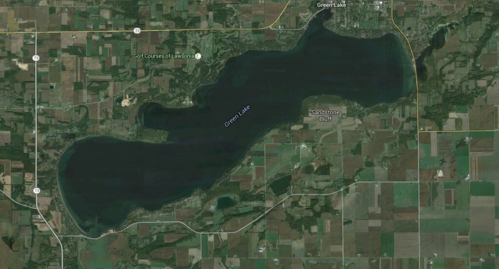
In 2016 Delta assisted the Green Lake Association (GLA) for Green Lake, Wisconsin, in developing an effective long-term approach to reducing phosphorus loading into the Green Lake watershed by leveraging existing research and tools, with a goal of demonstrable water quality improvement, watershed health, and sediment/nutrient reduction.
Why our Work is Needed
Green Lake is known as a weekend destination, with an array of outdoor recreational activities. Many of these recreational opportunities center around Green Lake, a notably deep Midwestern lake that has both the City of Green Lake and expansive agricultural fields adjacent to or on the lake shoreline. Indeed, with a surface area of 7,346 acres and a maximum depth of 236 feet, it is Wisconsin’s deepest natural inland lake. Green Lake contains a vast volume of water, nearly 250 billion gallons (or 762,000 acre-feet). If the lake were to be emptied, normal stream flow conditions would require at least 20 years for it to completely fill again.
Nutrient and sediment loading originating from sources throughout the lake’s watershed can threaten lake health, recreational pastimes and local economic development. The impact of unpredictable factors – such as the introduction of aquatic invasive species; more intense, more frequent rainfall events; and fluctuations in crop markets that impact total agricultural acres in the Conservation Reserve Program – have the potential to further degrade the lake’s water quality. In collaboration with Green Lake Association and its partners, Delta conducted a phosphorus loading analysis, developed a funding model, and a coordinated implementation.
Brief Overview of What We’re Doing
In 2016, Delta co-created The Green Lake Watershed Phosphorus Prioritization Tool (linked below) in partnership with the GLA, with the intent that this tool would be used to prioritize ongoing efforts, to inform potential new strategies, and to seek additional funding for BMPs to achieve the Green Lake watershed’s phosphorus reduction goals. In particular, the goals of the Phosphorus Prioritization Tool are to:
- Identify agricultural nutrient loading priority areas throughout the Green Lake watershed;
- Determine the location and type of best practices needed to achieve milestone annual phosphorus reduction goals of 25% by 2025 and 35% by 2035 through field-level implementation scenarios;
- Calculate the funding gap to install best practices that achieve milestone reduction goals, assuming projects are funded by the NRCS’ Environmental Quality
- Incentives Program (EQIP) program at 25%, 50% and 75%;
- Compile a list of potential grant opportunities that may cover the remaining funding gap; and,
- Provide the information necessary to enhance agricultural outreach that increases the adoption of conservation practices in the watershed.
Delta Institute conducted a nutrient loading analysis of the Green Lake watershed using a series of watershed models that incorporate information about topography, soils, rainfall and land cover. An Erosion Vulnerability Assessment for Agricultural Lands (EVAAL) for the Green Lake watershed was developed to identify areas that have moderate- to high-erosion indexes created by sheet, rill, and gully erosion. These results were compared to Green Lake’s 2015 Soil and Water Assessment Tool (SWAT) watershed model and other phosphorus loading data.
Existing agricultural BMPs (and those currently planned until 2017, at that time) were mapped based on information provided by the Green Lake County Land Conservation Department. Similar records and cost-share programs do not exist in Fond du Lac County. Results were used to identify 12 nutrient loading priority areas (NLPAs) – six in Green Lake County and six in Fond du Lac County – based on high-density clusters of high nutrient loading and low-density clusters of existing BMPs. These 12 NLPAs total 6,862 tillable acres in the watershed with an estimated 15,096 pounds of phosphorus loss annually (or 2.2 pounds/acre). These NLPAs were identified using EVAAL model results, aerial photographs, and other relevant digital data.
Ultimately, Delta’s recommendations were that the GLA focus on these areas when implementing future conservation practices, as they offer the highest rate of return for sediment and phosphorus reduction. Beyond those targeted areas, best field management practices can be implemented for phosphorus reductions throughout the watershed, regardless of whether they fall within or outside of the NLPAs so that the health and vibrancy of Green Lake can be enjoyed for generations to come.

